Bidspirit auction | Travel Poster Yorkshire Map British
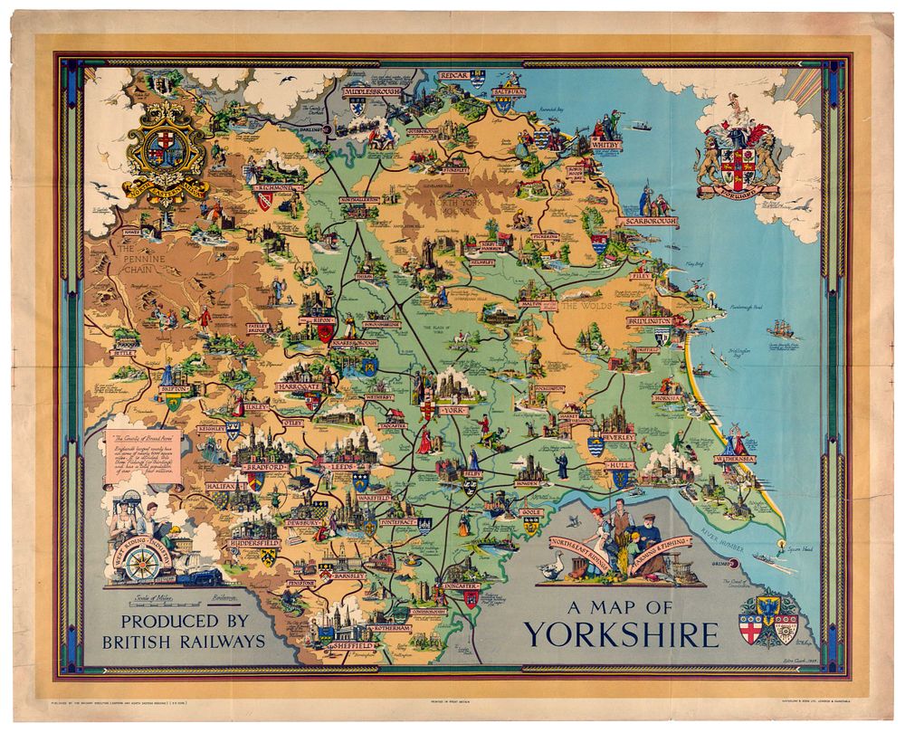
Travel Poster Yorkshire Map British Railways - Original vintage British Railways travel poster featuring a decorative pictorial map of Yorkshire - Design by the York-born artist Estra Clark (1904-1993) featuring the three historic Ridings of the county - North, West, and East - interspersed with vignettes showing local historical landmarks, regional wildlife, and geographical features such as the Pennine Chain, The Wolds and North York Moors.The map highlights the distinct local identities of the post-war era, showcasing a dedicated corner vignette for West Riding Industry complete with factory textile mills and coal miners, balanced by an illustration of ”Farming & Fishing” along the East and North Ridings. The map is further decorated with the official heraldic coat of arms for major towns and cities across the county, including York, Sheffield, Leeds, Bradford, and Hull. Published by The Railway Executive Eastern and North Eastern Regions. Printed in Great Britain by Waterlow and Sons London and Dunstable. Large size. Good condition, folds, creasing, large repaired tears, staining, some small paper losses. Country of issue: UK, designer: Estra Clark, size (cm): 103x129, year of printing: 1949.