Bidspirit auction | A Framed 1950 British Admiralty
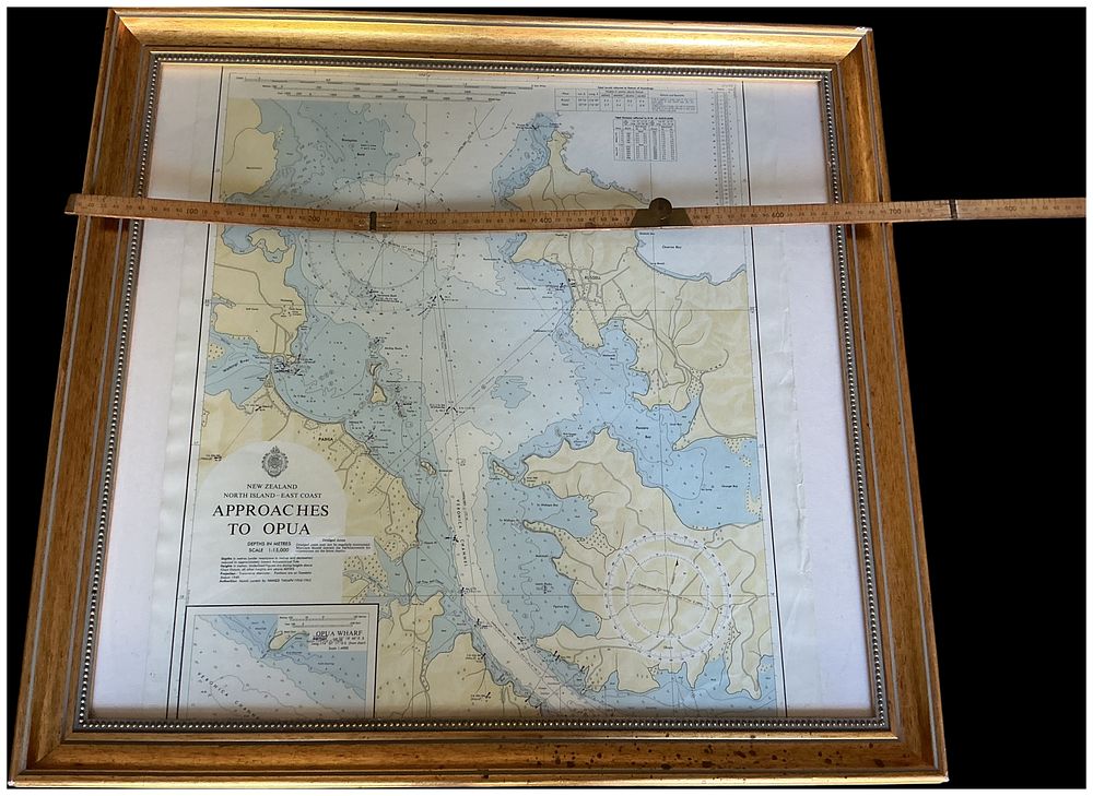
A Framed 1950 British Admiralty Nautical Chart of the Approaches to Opua, New Zealand. No Reserve.Cannot Post. - A framed and glazed vintage nautical chart detailing the approaches to Opua in the Bay of Islands, New Zealand. The chart, printed in monochrome with pale blue and yellow tints, is presented at a scale of 1:15,000 with depths recorded in metres. It features detailed bathymetric soundings, topographical land features, and a large compass rose in the lower right quadrant. A detailed inset map of Opua Wharf is located in the lower left corner. The document is set within a white mat and housed in a contemporary gilt-finish wooden frame featuring a beaded inner border. A printed crest of the British Admiralty Hydrographic Office is positioned above the title block. The central title block reads NEW ZEALAND / NORTH ISLAND — EAST COAST / APPROACHES / TO OPUA. Scale information is provided as DEPTHS IN METRES / SCALE 1:15,000. Text at the bottom left edge states Published at the Admiralty, 23rd June 1950, with further notes for Small corrections up to 1962. Geographic labels across the chart include VERONICA CHANNEL, PAHIA, and RUSSELL. Overall frame width: 850mm Sight size width: 730mm Overall frame height: 850mm.